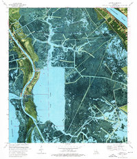
1973 Map of Lafitte
USGS Topo · Published 1976About this map
Bayou Barataria winds through this 1970s orthophotomap, anchoring a deltaic landscape where the fishing communities of Barataria and Lafitte are concentrated along the natural levees. The sheet provides a clear view of the transition from the Mississippi River at Ollie and Wills Point to the intricate network of marshland channels like Bayou de Fleur and Bayou des Oies. For genealogists, the map is particularly valuable for its precise location of family-named burial sites including Lafitte Cem, Coulon Cem, Adams Cem, and Fisher Cem. The heavy influence of coastal industry is evident in the straight cuts of the Barataria Waterway, the Pipeline corridors, and various Drill Holes, showing how petroleum and commerce reshaped the traditional landscape of Little Village and the open expanse of The Pen.
Find a feature on this map
32 named features on this map. Tap any name to fly to it.
Don’t see what you’re looking for? This feature index may not catch every label — zoom into the map to look around manually.
Map Details
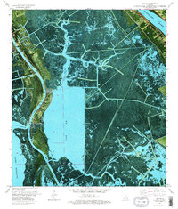
Editions of this 1973 Lafitte Map
2 editions found
Other maps of this area

1891 · Pointe a La Hache
USGS Topo · 1:62,500

1891 · New Orleans
USGS Topo · 1:62,500

1892 · Barataria
USGS Topo · 1:62,500

1892 · St. Bernard
USGS Topo · 1:62,500

1892 · Pointe a La Hache
USGS Topo · 1:62,500

1932 · New Orleans SE
USGS Topo · 1:31,680

1932 · New Orleans SW
USGS Topo · 1:31,680

1939 · Pointe a La Hache
USGS Topo · 1:62,500
1940 · Belle Chasse
USGS Topo · 1:31,680
1940 · Bertrandville
USGS Topo · 1:31,680