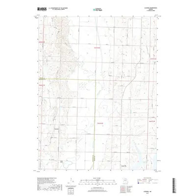
2017 Map of Lagonda
USGS Topo · Published 2017About this map
The Chariton River carves a broad valley through the center of this rural landscape on the border of Macon and Chariton counties. Settlement is concentrated in the small communities of Lagonda and Kaseyville, the latter situated near the northern reaches of the Thomas Hill Reservoir. The region's agricultural character is punctuated by several small, family-named burial grounds, including the Rice Cem and Dodson Cem, which serve as vital landmarks for local genealogical research. In the southwest, the suggestive name of Coal Mine Ave alludes to the area's subterranean history, while natural drainage features like Puzzle Cr and Swan Lake define the bottomlands. The map reveals a transition from the structured grid of rural roads, such as Lagonda Rd, to the more irregular topography of Sleepy Hollow.
Find a feature on this map
56 named features on this map. Tap any name to fly to it.
Don’t see what you’re looking for? This feature index may not catch every label — zoom into the map to look around manually.
Map Details
Editions of this 2017 Lagonda Map
This is the sole edition of this map. No revisions or reprints were ever made.
Other maps of this area

1937 · Elmer
USGS Topo · 1:48,000

1942 · Elmer
USGS Topo · 1:62,500

1950 · New Cambria West
USGS Topo · 1:24,000

1953 · Moberly
USGS Topo · 1:250,000

1953 · Bevier South
USGS Topo · 1:24,000

1953 · College Mound
USGS Topo · 1:24,000

1953 · Prairie Hill
USGS Topo · 1:24,000

1953 · Lagonda
USGS Topo · 1:24,000

1953 · Wien
USGS Topo · 1:24,000

1953 · Bynumville
USGS Topo · 1:24,000