
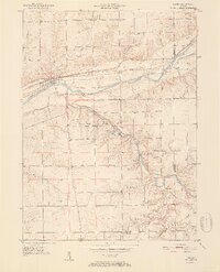
1951 Map of Lagro
USGS Topo · Published 1951About this map
The Wabash River and Salamonie River converge in this mid-century portrait of Wabash County, where the settlement of Lagro serves as a primary hub. The landscape is defined by the heavy infrastructure of the Wabash RR and a network of rural roads connecting scattered communities like Dora, New Holland, and Lincolnville. Cultural landmarks are prominent, including several country churches such as Hopewell Ch and Bethel Ch, alongside small family or community burial grounds like Leedy Cem and Center Grove Cem.
Find a feature on this map
30 named features on this map. Tap any name to fly to it.
Don’t see what you’re looking for? This feature index may not catch every label — zoom into the map to look around manually.
Map Details
Editions of this 1951 Lagro Map
2 editions found
Other maps of this area

1950 · Lagro
USGS Topo · 1:24,000

1950 · Andrews
USGS Topo · 1:24,000

1950 · Mount Etna
USGS Topo · 1:24,000

1951 · Mount Etna
USGS Topo · 1:24,000

1951 · Andrews
USGS Topo · 1:24,000

1952 · Wabash
USGS Topo · 1:24,000

1953 · La Fontaine
USGS Topo · 1:24,000

1953 · Somerset
USGS Topo · 1:24,000

1953 · Muncie
USGS Topo · 1:250,000

1955 · Bippus
USGS Topo · 1:24,000