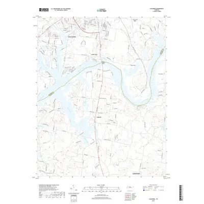
2019 Map of Laguardo
USGS Topo · Published 2019About this map
The Cumberland River defines the heart of this landscape as it meanders through the boundary of Sumner and Wilson counties. At its center, the community of Laguardo sits along the southern bank, while the city of Gallatin occupies the northern uplands, marked by a dense network of suburban streets and residential roads like Nashville Pike. The waterway's dramatic loops create distinctive landforms such as Odoms Bend and Cairo Bend, with the Martha Gallatin Bridge providing a critical connection across the river. Local hydrology is further shaped by several small lakes and drainage basins, including Ackers Lake and L A Green Lake. Away from the main river channel, the terrain is carved by numerous tributaries like Spencer Creek, Bulls Creek, and Bartons Creek, illustrating the natural drainage patterns that have influenced local settlement from the era of rural farms to modern development.
Find a feature on this map
164 named features on this map. Tap any name to fly to it.
Don’t see what you’re looking for? This feature index may not catch every label — zoom into the map to look around manually.
Map Details
Editions of this 2019 Laguardo Map
This is the sole edition of this map. No revisions or reprints were ever made.
Other maps of this area

1903 · Nashville
USGS Topo · 1:125,000

1932 · Hermitage
USGS Topo · 1:62,500

1942 · Gallatin
USGS Topo · 1:100,000

1942 · Lebanon
USGS Topo · 1:100,000

1951 · Lebanon
USGS Topo · 1:24,000

1951 · Martha
USGS Topo · 1:24,000

1952 · Hendersonville
USGS Topo · 1:24,000

1952 · Hermitage
USGS Topo · 1:24,000

1953 · Cottontown
USGS Topo · 1:24,000

1955 · Bethpage
USGS Topo · 1:24,000