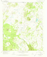
1961 Map of Laguna Canoneros
USGS Topo · Published 1973About this map
Cebolleta Mesa dominates this high-altitude landscape on the boundary between McKinley and Valencia counties in the early 1960s. The region is characterized by a complex network of seasonal water sources and named tanks essential for life in the arid highlands, including the John Nelson Tank and Piedra Tank. Small outposts like Cuates Camp and Cañoneros Camp reflect the remote ranching or resource management activity of the era, while the name Casa Fria identifies a specific point of human habitation near the Seboyetita Creek drainage. To the northwest, the Cibola National Forest encompasses the high country near Cerro Cuate. The map also captures a curiously named feature, the Panama Canal, which sits near Laguna de Damacio on the mesa top. Drainage systems such as Seboyeta Creek and Rio Paguate flow from the mesas, carving the canyons that define the local topography.
Find a feature on this map
43 named features on this map. Tap any name to fly to it.
Don’t see what you’re looking for? This feature index may not catch every label — zoom into the map to look around manually.
Map Details
Editions of this 1961 Laguna Canoneros Map
2 editions found
Other maps of this area

1883 · Mt. Taylor
USGS Topo · 1:250,000

1886 · Mt. Taylor
USGS Topo · 1:250,000

1892 · Mt. Taylor
USGS Topo · 1:250,000

1899 · Mt. Taylor
USGS Topo · 1:250,000

1957 · Mount Taylor
USGS Topo · 1:24,000

1957 · Moquino
USGS Topo · 1:24,000

1957 · Seboyeta
USGS Topo · 1:24,000

1958 · Albuquerque
USGS Topo · 1:250,000

1961 · Marquez
USGS Topo · 1:24,000

1961 · El Dado Mesa
USGS Topo · 1:24,000