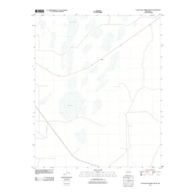
2010 Map of Laguna Del Perro South
USGS Topo · Published 2010About this map
Salina Lake and the southern reaches of Laguna del Perro define this high-desert basin in the Estancia Valley. This region of New Mexico is characterized by its significant saline playa lakes, which are clearly delineated in this early 21st-century survey. The settlement of Silio sits near the center of the sheet along the primary road route, serving as a focal point for the surrounding rural ranching landscape. The map provides a detailed view of the localized drainage patterns and topographic depressions that feed these interior basins, including the course of County Rd-B058 which connects the isolated homesteads and grazing lands. The geography here is a closed-basin system, where the presence of these expansive salt flats indicates the unique hydrological character of Torrance County.
Find a feature on this map
4 named features on this map. Tap any name to fly to it.
Don’t see what you’re looking for? This feature index may not catch every label — zoom into the map to look around manually.
Map Details
Editions of this 2010 Laguna Del Perro South Map
This is the sole edition of this map. No revisions or reprints were ever made.
Other maps of this area

1917 · Estancia
USGS Topo · 1:125,000

1954 · Fort Sumner
USGS Topo · 1:250,000

1954 · Socorro
USGS Topo · 1:250,000

1956 · Mountainair
USGS Topo · 1:62,500

1958 · Socorro
USGS Topo · 1:250,000

1958 · Fort Sumner
USGS Topo · 1:250,000

1962 · Socorro
USGS Topo · 1:250,000
1972 · Round Top
USGS Topo · 1:24,000

1978 · Laguna Del Perro North
USGS Topo · 1:24,000

1978 · Laguna Del Perro South
USGS Topo · 1:24,000