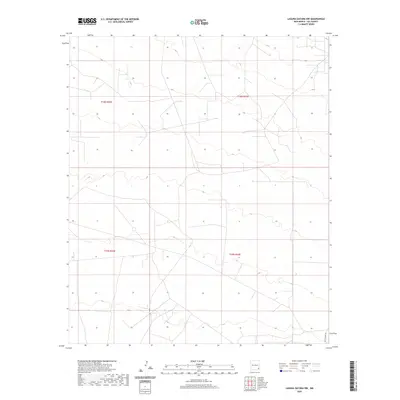
2020 Map of Laguna Gatuna NW
USGS Topo · Published 2020About this map
Lea County's arid basin landscape is defined here by the sparse infrastructure typical of New Mexico's oil and ranching country. The terrain is marked by the expansive grid of the Public Land Survey System, including boundaries for t18s r32e, t18s r33e, t19s r32e, and t19s r33e. Transportation is limited to a network of local roads and 4WD tracks that cut across the contours, with Smith Ranch Rd serving as a primary connector in the southeastern corner. This modern survey captures the region's characteristic isolation and the large-scale land management patterns of the high desert.
Find a feature on this map
5 named features on this map. Tap any name to fly to it.
Don’t see what you’re looking for? This feature index may not catch every label — zoom into the map to look around manually.
Map Details
Editions of this 2020 Laguna Gatuna NW Map
This is the sole edition of this map. No revisions or reprints were ever made.
Other maps of this area

1942 · Clayton Basin
USGS Topo · 1:62,500

1943 · Clayton Basin
USGS Topo · 1:62,500

1954 · Hobbs
USGS Topo · 1:250,000

1958 · Hobbs
USGS Topo · 1:250,000

1962 · Buckeye
USGS Topo · 1:62,500

1963 · Laguna Gatuna
USGS Topo · 1:62,500

1963 · Maljamar
USGS Topo · 1:62,500

1984 · Lea
USGS Topo · 1:24,000

1984 · Ironhouse Well
USGS Topo · 1:24,000

1984 · Laguna Gatuna NW
USGS Topo · 1:24,000