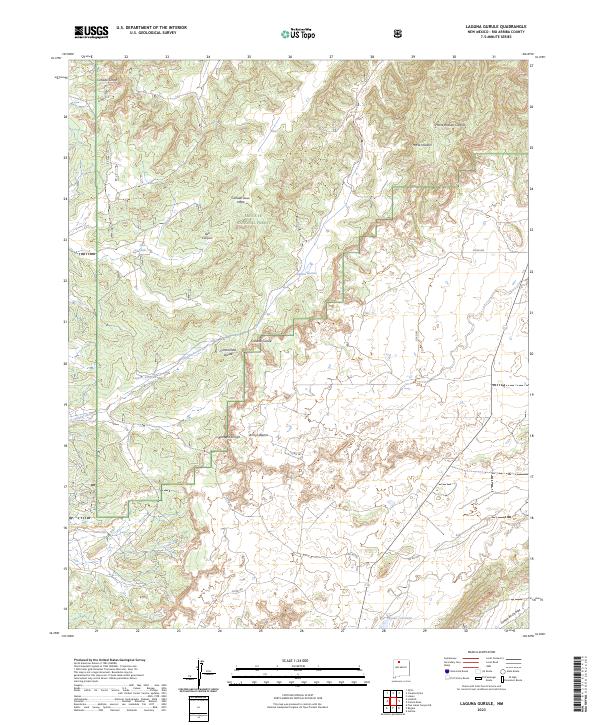
2023 Map of Laguna Gurule
USGS Topo · Published 2023About this map
The Continental Divide winds through this high-altitude landscape in Rio Arriba County, defining the drainage patterns of the Santa Fe National Forest. This 2023 survey illustrates a region where water management and topography are inextricably linked, evidenced by features such as Oso Tank and the namesake Laguna Gurule. The terrain is deeply incised by a network of seasonal drainages, including the Cañada Jesus Moya and Cañada Gurule, which feed into various lagunas. These water bodies, including Laguna Jacquez and Laguna Colorada, represent critical landmarks in an area dominated by canyon systems like Oso Canyon and the evocatively named Horse Heaven. The map provides a contemporary look at the ranching and forest infrastructure, showing various county roads such as Co RD 387 and Co RD 390 that navigate the high-desert plateaus and arroyos.
Find a feature on this map
30 named features on this map. Tap any name to fly to it.
Don’t see what you’re looking for? This feature index may not catch every label — zoom into the map to look around manually.
Map Details
Editions of this 2023 Laguna Gurule Map
This is the sole edition of this map. No revisions or reprints were ever made.
Other maps of this area

1889 · Largo
USGS Topo · 1:250,000

1895 · Largo
USGS Topo · 1:250,000

1909 · Gallina
USGS Topo · 1:125,000

1940 · Cuba
USGS Topo · 1:62,500

1943 · Cuba
USGS Topo · 1:62,500

1954 · Aztec
USGS Topo · 1:250,000

1955 · Llaves
USGS Topo · 1:62,500

1958 · Aztec
USGS Topo · 1:250,000

1962 · Aztec
USGS Topo · 1:250,000

1963 · Lindrith
USGS Topo · 1:24,000