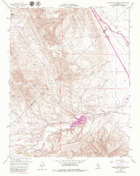
1956 Map of Laguna Seca Ranch
USGS Topo · Published 1979About this map
Laguna Seca Ranch and the Barneich Ranch anchor this landscape along the border of Merced Co Fresno Co during the mid-twentieth century. The terrain is defined by the sharp transition from the elevated Panoche Hills and Wildcat Canyon down into the Little Panoche Valley. This 1970s update specifically captures the infrastructure of the California State Water Project, prominently featuring the Little Panoche Reservoir and the massive path of the California Aqueduct cutting across the valley floor. Researchers will find a network of resource management and transport indicators, from the Fire Line and numerous Water Tanks to the Little Panoche Road following the path of Panoche Creek. The presence of a Gravel Pit and multiple Pipelines underscores the industrial and water-management utility of this Merced and Fresno County border region.
Find a feature on this map
20 named features on this map. Tap any name to fly to it.
Don’t see what you’re looking for? This feature index may not catch every label — zoom into the map to look around manually.
Map Details
Editions of this 1956 Laguna Seca Ranch Map
4 editions found
Other maps of this area

1913 · Panoche
USGS Topo · 1:125,000

1920 · Carrisalito Spring
USGS Topo · 1:31,680

1921 · Laguna Seca Ranch
USGS Topo · 1:31,680

1921 · Tierra Loma School
USGS Topo · 1:31,680

1922 · Charleston School
USGS Topo · 1:31,680

1922 · Dos Palos
USGS Topo · 1:31,680

1922 · Ortigalita
USGS Topo · 1:31,680

1923 · Laguna Seca Ranch
USGS Topo · 1:31,680

1923 · Tierra Loma School
USGS Topo · 1:31,680

1923 · Little Panoche
USGS Topo · 1:31,680