
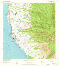
1956 Map of Lahaina
USGS Topo · Published 1959About this map
The agricultural and maritime landscape of West Maui dominates this 1950s survey, revealing a network of irrigation systems essential to the regional economy. In the coastal town of Lahaina, a central Sugar Mill and Pineapple Cannery signify the industrial backbone of the era. Uplands are carved by numerous flumes, ditches, and tunnels that channel water from sources like Violet Lake and Kahoma Stream to reservoirs including Hanakaöo Reservoir and Wahikuli Reservoir.
Find a feature on this map
81 named features on this map. Tap any name to fly to it.
Don’t see what you’re looking for? This feature index may not catch every label — zoom into the map to look around manually.
Map Details
Editions of this 1956 Lahaina Map
2 editions found
Other maps of this area

1954 · Maui
USGS Topo · 1:250,000

1954 · Maalaea
USGS Topo · 1:24,000

1955 · Olowalu
USGS Topo · 1:24,000

1955 · Wailuku
USGS Topo · 1:24,000

1955 · Kahakuloa
USGS Topo · 1:24,000

1956 · Honolua
USGS Topo · 1:24,000

1966 · Maui
USGS Topo · 1:250,000

1974 · Maui
USGS Topo · 1:250,000

1977 · Wailuku
USGS Topo · 1:24,000
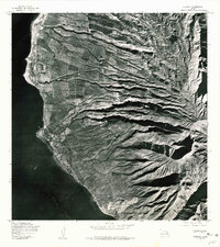
1978 · Lahaina
USGS Topo · 1:24,000