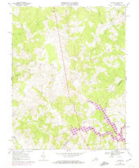
1968 Map of Lahore
USGS Topo · Published 1974About this map
Lake Anna dominates the southeastern quadrant of this landscape, its newly formed shoreline reaching into the valleys of Terrys Run and Beverly Run. This survey, updated with 1973 photogrammetric revisions, documents the dramatic transformation of the North Anna River basin during the reservoir's creation. The surrounding terrain of Orange Co remains rural, defined by a dense network of country churches and small crossroads settlements that served as the social backbone for generations of Virginia families. From Lahore and Monrovia to Thornhill, the map preserves the traditional placement of landmarks like Kirk O'Cliff Ch and Lightfoot Sch before modern development altered the rural character of the region. A prominent Pipeline cuts a straight path north-to-south across the drainage of Pamunkey Creek, contrasting with the winding courses of Little Creek and Riga Run.
Find a feature on this map
39 named features on this map. Tap any name to fly to it.
Don’t see what you’re looking for? This feature index may not catch every label — zoom into the map to look around manually.
Map Details
Editions of this 1968 Lahore Map
3 editions found
Other maps of this area

1887 · Spottsylvania
USGS Topo · 1:125,000

1892 · Spottsylvania
USGS Topo · 1:125,000

1892 · Gordonsville
USGS Topo · 1:125,000

1942 · Mineral
USGS Topo · 1:31,680

1942 · Lahore
USGS Topo · 1:31,680

1942 · Belmont
USGS Topo · 1:31,680

1942 · Contrary Creek
USGS Topo · 1:31,680

1943 · Mine Run
USGS Topo · 1:24,000

1943 · Unionville
USGS Topo · 1:24,000
1944 · Unionville
USGS Topo · 1:31,680