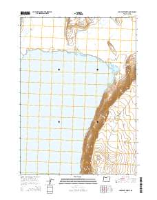
2014 Map of Lake Abert North
USGS Topo · Published 2014About this map
Lake Abert dominates the western portion of this 2014 survey, a significant endorheic water body in the high desert of Lake County. Along its eastern shore, the dramatic elevation change of the Abert Rim creates a sharp geological boundary, where steep escarpments rise above the lake basin. This fault-block ridge is a defining feature of the Great Basin landscape, directing the course of the Lakeview-Burns Hwy as it skirts the base of the cliffs. In the more arid terrain east of the rim, smaller features like Highway Spring and the ephemeral Thorne and Wisdom Lake indicate the scarce water resources of the region. The map captures the remote character of this Oregon corridor, where infrastructure is dictated by the massive scale of the ancient lake bed and its surrounding vertical reliefs.
Find a feature on this map
11 named features on this map. Tap any name to fly to it.
Don’t see what you’re looking for? This feature index may not catch every label — zoom into the map to look around manually.
Map Details
Editions of this 2014 Lake Abert North Map
This is the sole edition of this map. No revisions or reprints were ever made.
Other maps of this area

1955 · Klamath Falls
USGS Topo · 1:250,000

1958 · Klamath Falls
USGS Topo · 1:250,000

1966 · Coglan Buttes NE
USGS Topo · 1:24,000

1966 · Coglan Buttes SE
USGS Topo · 1:24,000

1968 · Lake Abert North
USGS Topo · 1:24,000

1968 · Lake Abert South
USGS Topo · 1:24,000
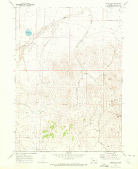
1968 · Cooper Draw
USGS Topo · 1:24,000

1968 · Commodore Ridge
USGS Topo · 1:24,000

1974 · Lake Abert
USGS Topo · 1:100,000
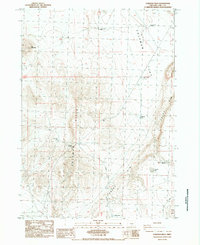
1984 · Coleman Hills
USGS Topo · 1:24,000