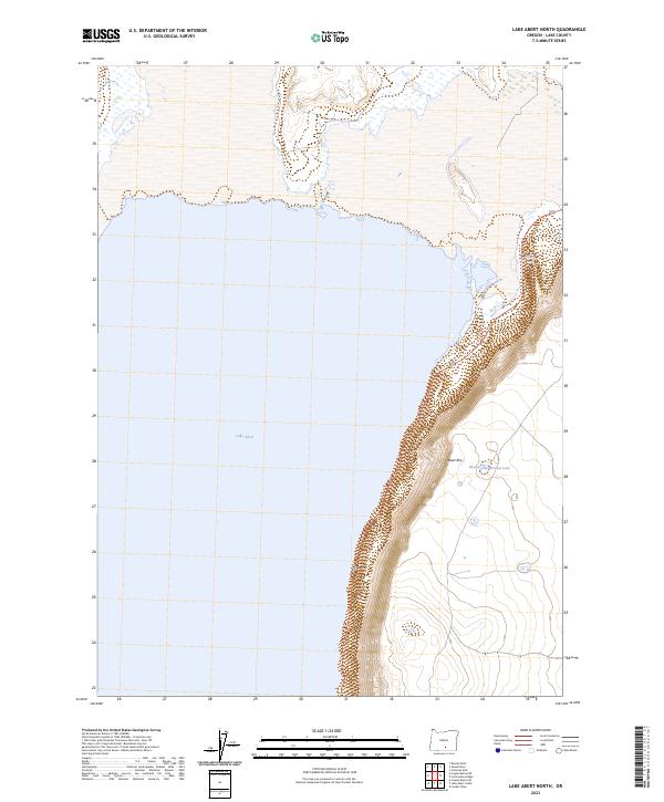
2023 Map of Lake Abert North
USGS Topo · Published 2023About this map
Abert Rim dominates the eastern edge of this landscape, its sharp escarpment rising abruptly from the waters of Lake Abert. This portion of Lake County is defined by the high desert topography of the Great Basin, where the saline waters of the lake reflect the sheer verticality of the rim above. Modern transportation is represented by US Route 395, which traces the narrow strip of land between the cliffs and the shoreline, providing the primary access through this sparsely developed area.
Find a feature on this map
11 named features on this map. Tap any name to fly to it.
Don’t see what you’re looking for? This feature index may not catch every label — zoom into the map to look around manually.
Map Details
Editions of this 2023 Lake Abert North Map
This is the sole edition of this map. No revisions or reprints were ever made.
Other maps of this area

1955 · Klamath Falls
USGS Topo · 1:250,000

1958 · Klamath Falls
USGS Topo · 1:250,000

1966 · Coglan Buttes NE
USGS Topo · 1:24,000

1966 · Coglan Buttes SE
USGS Topo · 1:24,000

1968 · Lake Abert North
USGS Topo · 1:24,000

1968 · Lake Abert South
USGS Topo · 1:24,000
1968 · Cooper Draw
USGS Topo · 1:24,000

1968 · Commodore Ridge
USGS Topo · 1:24,000

1974 · Lake Abert
USGS Topo · 1:100,000
1984 · Coleman Hills
USGS Topo · 1:24,000