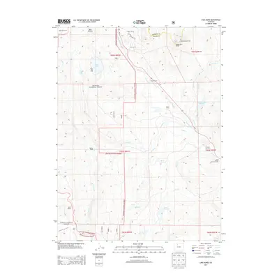
2013 Map of Lake Agnes
USGS Topo · Published 2013About this map
The Continental Divide serves as a natural spine for this high-country landscape on the border of Jackson and Grand counties. This alpine region is defined by the intersections of the Arapaho National Forest, Routt National Forest, and the Rabbit Ears Range. The distribution of human activity is clustered near water sources and transportation corridors, featuring several working mountain properties such as Martin Ranch and the De Berard Peak Ranch. At higher elevations, the landscape is punctuated by prominent peaks like Baker Mountain and secluded water bodies including Lily Lake and Lake Agnes. The presence of the Smole Sawmill and the State Highway Maintenance Camp suggests a local economy and infrastructure focused on timber and high-altitude road maintenance during this period in the early 2010s.
Find a feature on this map
39 named features on this map. Tap any name to fly to it.
Don’t see what you’re looking for? This feature index may not catch every label — zoom into the map to look around manually.
Map Details
Editions of this 2013 Lake Agnes Map
This is the sole edition of this map. No revisions or reprints were ever made.
Other maps of this area

1954 · Craig
USGS Topo · 1:250,000

1956 · Rabbit Ears Peak
USGS Topo · 1:24,000

1956 · Lake Agnes
USGS Topo · 1:24,000

1956 · Kremmling
USGS Topo · 1:62,500

1956 · Spicer Peak
USGS Topo · 1:24,000

1956 · Whiteley Peak
USGS Topo · 1:24,000

1956 · Storm Mountain
USGS Topo · 1:24,000

1956 · Walton Peak
USGS Topo · 1:24,000

1956 · Gore Pass
USGS Topo · 1:62,500

1956 · Hyannis Peak
USGS Topo · 1:62,500