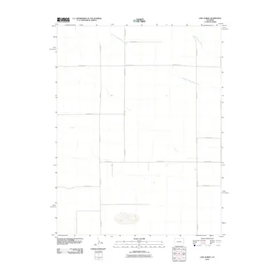
2010 Map of Lake Albert
USGS Topo · Published 2010About this map
White Woman Creek and its tributary, South Fork White Woman Creek, define the subtle drainage patterns of this high plains landscape in Cheyenne County. The terrain is structured by a rigid section-line grid of rural routes, including County Road A and County Road V, which facilitate access across this agricultural expanse. This 2010 survey by the U.S. Geological Survey captures the area in a period of modern land management, where the intersection of north-south arteries like County Rd-71 and County Rd-75 with east-west roads like County Road W illustrates the precise organization of the Western interior.
Find a feature on this map
12 named features on this map. Tap any name to fly to it.
Don’t see what you’re looking for? This feature index may not catch every label — zoom into the map to look around manually.
Map Details
Editions of this 2010 Lake Albert Map
This is the sole edition of this map. No revisions or reprints were ever made.
Other maps of this area

1890 · Granada
USGS Topo · 1:125,000

1892 · Cheyenne Wells
USGS Topo · 1:125,000

1892 · Granada
USGS Topo · 1:125,000

1894 · Cheyenne Wells
USGS Topo · 1:125,000

1894 · Granada
USGS Topo · 1:125,000

1954 · Lamar
USGS Topo · 1:250,000

1958 · Lamar
USGS Topo · 1:250,000

1968 · Stuart
USGS Topo · 1:24,000

1968 · Sheridan Lake
USGS Topo · 1:24,000
1968 · Towner
USGS Topo · 1:24,000