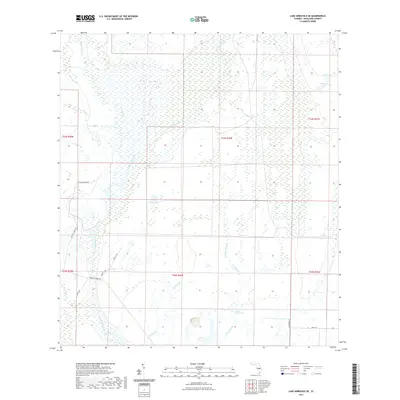
2021 Map of Lake Arbuckle SE
USGS Topo · Published 2021About this map
Arbuckle Cr and its tributaries define this landscape in Highlands County, where an intricate network of waterways like Morgan Hole Cr and Wildcat Br wind through the interior. The terrain is characterized by low-lying wetlands and unique features such as Long Cypress Slash and Bonny Bloom Pond. In the northeast, the curiously named Submarine Lake sits adjacent to Little Lake, highlighting the region's distinct hydrography. Large agricultural holdings and rural infrastructure are evident through names like Raffert Ranch Rd and Rafter T Ranch Rd. The presence of Scrubpens Rd and Arbuckle Creek Rd provides a look at the modern rural transport network used to navigate this swampy and creek-fed portion of Florida.
Find a feature on this map
24 named features on this map. Tap any name to fly to it.
Don’t see what you’re looking for? This feature index may not catch every label — zoom into the map to look around manually.
Map Details
Editions of this 2021 Lake Arbuckle SE Map
This is the sole edition of this map. No revisions or reprints were ever made.
Other maps of this area

1952 · Fort Kissimmee
USGS Topo · 1:24,000

1952 · Lake Arbuckle SW
USGS Topo · 1:24,000

1952 · Fort Kissimmee NW
USGS Topo · 1:24,000

1952 · Lake Arbuckle NE
USGS Topo · 1:24,000

1952 · Lake Arbuckle SE
USGS Topo · 1:24,000

1952 · Lake Arbuckle
USGS Topo · 1:24,000

1952 · Lorida
USGS Topo · 1:24,000

1952 · Sebring
USGS Topo · 1:24,000

1953 · Basinger NW
USGS Topo · 1:24,000

1956 · Fort Pierce
USGS Topo · 1:250,000