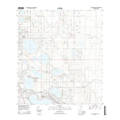
2015 Map of Lake Arbuckle SW
USGS Topo · Published 2015About this map
Avon Park and northern Sebring define the urban character of this central Florida landscape, situated within a high density of named water bodies. The geography is dominated by a chain of lakes, from the large expanse of Lake Jackson and Dinner Lake in the south to Lake Lotela and Lake Verona near the center of the survey. The road network, including Arbuckle Creek Rd and E Old Bombing Range Rd, weaves through citrus-growing regions and residential developments like Sebring Shores. Small waterways like Carter Cr and Palmetto Cr provide drainage between the basins. For local historians, the inclusion of Lakeside Cem and Pinecrest Cem offers specific points of interest for genealogical research in Highlands County. The map captures the suburban expansion between these two established Florida cities as it appeared in the mid-2010s.
Find a feature on this map
76 named features on this map. Tap any name to fly to it.
Don’t see what you’re looking for? This feature index may not catch every label — zoom into the map to look around manually.
Map Details
Editions of this 2015 Lake Arbuckle SW Map
This is the sole edition of this map. No revisions or reprints were ever made.
Other maps of this area

1952 · Lake Arbuckle SW
USGS Topo · 1:24,000

1952 · Lake Arbuckle NE
USGS Topo · 1:24,000

1952 · Lake Arbuckle SE
USGS Topo · 1:24,000

1952 · Lake Arbuckle
USGS Topo · 1:24,000

1952 · Lorida
USGS Topo · 1:24,000

1952 · Sebring
USGS Topo · 1:24,000

1953 · Frostproof
USGS Topo · 1:24,000

1953 · Avon Park
USGS Topo · 1:24,000

1953 · Crewsville
USGS Topo · 1:24,000

1956 · Fort Pierce
USGS Topo · 1:250,000