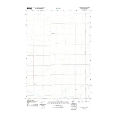
2010 Map of Lake Benton SW
USGS Topo · Published 2010About this map
Medary Creek winds through the southeastern portion of this South Dakota landscape, providing a primary drainage feature for the surrounding agricultural grid. The terrain is organized by a systematic network of section lines and township roads, including 486th Ave and 487th Ave, which define the rural character of the area. A significant landmark for local history and genealogy is Stolz Cemetery, situated along the lower reaches of the creek near County Hwy-101. The map documents a predominantly agrarian environment where County Highways such as County Hwy-1 and County Hwy-13 facilitate movement between the scattered farmsteads and fields of Richland Township during the early 21st century.
Find a feature on this map
17 named features on this map. Tap any name to fly to it.
Don’t see what you’re looking for? This feature index may not catch every label — zoom into the map to look around manually.
Map Details
Editions of this 2010 Lake Benton SW Map
This is the sole edition of this map. No revisions or reprints were ever made.
Other maps of this area

1953 · Watertown
USGS Topo · 1:250,000

1958 · Watertown
USGS Topo · 1:250,000

1967 · Verdi
USGS Topo · 1:24,000

1967 · Lake Benton NW
USGS Topo · 1:24,000

1967 · Lake Benton
USGS Topo · 1:24,000

1967 · Lake Benton SW
USGS Topo · 1:24,000

1967 · Lake Benton NE
USGS Topo · 1:24,000

1967 · Elkton
USGS Topo · 1:24,000

1970 · White NE
USGS Topo · 1:24,000

1972 · Flandreau NE
USGS Topo · 1:24,000