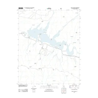
2012 Map of Lake Cachuma
USGS Topo · Published 2012About this map
Cachuma Village sits at the edge of a massive reservoir landscape defined by the impounded waters of the Santa Ynez River. This 2012 survey details the complex geography of the reservoir, including Cachuma Bay and Santa Cruz Bay, controlled at its western end by Bradbury Dam. The area is characterized by large private holdings and recreational camps, such as the Rancho San Fernando Rey, Storke Ranch, and the Rancho Alegre Boy Scout Camp. In the high country to the south, the Santa Ynez Mountains rise sharply toward Santa Ynez Peak and Broadcast Peak. Significant water infrastructure is noted here, specifically the entrance to the Tecolote Tunnel and a natural Hot Spring in the southeastern canyons. The map tracks the winding course of the W Cam Cielo along the ridgeline, offering a look at the backcountry roads and canyon networks like Johnson Canyon and Middle Canyon that feed the basin.
Find a feature on this map
46 named features on this map. Tap any name to fly to it.
Don’t see what you’re looking for? This feature index may not catch every label — zoom into the map to look around manually.
Map Details
Editions of this 2012 Lake Cachuma Map
This is the sole edition of this map. No revisions or reprints were ever made.
Other maps of this area

1902 · Santa Ynez
USGS Topo · 1:125,000

1905 · Santa Ynez
USGS Topo · 1:125,000

1905 · Lompoc
USGS Topo · 1:125,000

1941 · San Rafael Mtn.
USGS Topo · 1:62,500

1942 · Lompoc
USGS Topo · 1:125,000

1942 · Gaviota
USGS Topo · 1:62,500

1942 · Goleta
USGS Topo · 1:62,500

1942 · San Rafael Mtn.
USGS Topo · 1:62,500

1942 · Los Olivos
USGS Topo · 1:62,500

1943 · San Rafael Mtn.
USGS Topo · 1:62,500