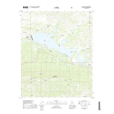
2018 Map of Lake Cachuma
USGS Topo · Published 2018About this map
Cachuma Village sits at the western edge of Lake Cachuma, a central reservoir along the Santa Ynez River that dominates the northern half of this landscape. To the south, the terrain rises sharply into the Santa Ynez Mountains, where prominent summits like Santa Ynez Peak and Broadcast Peak overlook the coastal drainage systems. This high country is largely contained within the Los Padres National Forest, characterized by deep canyons such as Tequepis Canyon and Dos Pueblos Canyon.
Find a feature on this map
52 named features on this map. Tap any name to fly to it.
Don’t see what you’re looking for? This feature index may not catch every label — zoom into the map to look around manually.
Map Details
Editions of this 2018 Lake Cachuma Map
This is the sole edition of this map. No revisions or reprints were ever made.
Other maps of this area

1902 · Santa Ynez
USGS Topo · 1:125,000

1905 · Santa Ynez
USGS Topo · 1:125,000

1905 · Lompoc
USGS Topo · 1:125,000

1941 · San Rafael Mtn.
USGS Topo · 1:62,500

1942 · Lompoc
USGS Topo · 1:125,000

1942 · Gaviota
USGS Topo · 1:62,500

1942 · Goleta
USGS Topo · 1:62,500

1942 · San Rafael Mtn.
USGS Topo · 1:62,500

1942 · Los Olivos
USGS Topo · 1:62,500

1943 · San Rafael Mtn.
USGS Topo · 1:62,500