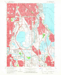
1965 Map of Lake Calumet
USGS Topo · Published 1966About this map
Industrial infrastructure and dense neighborhood networks define the South Side of Chicago and Northwest Indiana during the mid-1960s. The landscape is dominated by the massive basin of Lake Calumet, a hub for shipping and manufacturing anchored by the Thomas J O'Brien Lock and Dam. To the south, the planned community of Altgeld Gardens stands near the winding Little Calumet River, while the heavy rail presence of the Pennsylvania RR and Illinois Central RR crisscrosses the region.
Find a feature on this map
127 named features on this map. Tap any name to fly to it.
Don’t see what you’re looking for? This feature index may not catch every label — zoom into the map to look around manually.
Map Details
Editions of this 1965 Lake Calumet Map
4 editions found
Other maps of this area

1889 · Chicago
USGS Topo · 1:62,500

1891 · Chicago
USGS Topo · 1:62,500

1892 · Calumet
USGS Topo · 1:62,500

1893 · Calumet
USGS Topo · 1:62,500

1900 · Chicago
USGS Topo · 1:62,500

1900 · Toleston
USGS Topo · 1:62,500

1900 · Calumet
USGS Topo · 1:62,500

1901 · Calumet
USGS Topo · 1:62,500

1901 · Chicago
USGS Topo · 1:62,500

1929 · Calumet Lake
USGS Topo · 1:24,000
Featured Places
- Chicago, IL
- Hammond, North Township
- Calumet City, Thornton Township
- Dolton, Thornton Township
- Riverdale, IL