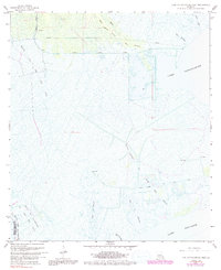
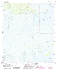
1967 Map of Lake Cataouatche West
USGS Topo · Published 1991About this map
Lake Cataouatche and Lake Salvador dominate this coastal landscape at the intersection of St. Charles and Lafourche parishes. This 1960s environment is defined by an intricate network of waterways including Bayou Couba and Bayou des Allemands, which weave through the wetlands. The industrial footprint of the era is evident in the sprawling Boutte Oil and Gas Field, marked by numerous pipelines and drill holes that cut across the marshes. Historically significant tracts like the Louisiana Cypress Lumber area reflect the region's timber heritage, while features such as Baie des Chactas and Baie du Cabanage hint at earlier French and Indigenous cultural influences on the geography. The presence of the Bois Piquant Canal further illustrates the mid-century effort to navigate and utilize these low-lying Louisiana wetlands.
Find a feature on this map
17 named features on this map. Tap any name to fly to it.
Don’t see what you’re looking for? This feature index may not catch every label — zoom into the map to look around manually.
Map Details
Editions of this 1967 Lake Cataouatche West Map
5 editions found
Other maps of this area

1891 · Hahnville
USGS Topo · 1:62,500

1891 · New Orleans
USGS Topo · 1:62,500

1892 · Barataria
USGS Topo · 1:62,500

1892 · Cut-Off
USGS Topo · 1:62,500

1932 · New Orleans NW
USGS Topo · 1:31,680

1932 · New Orleans SW
USGS Topo · 1:31,680

1932 · Hahnville NW
USGS Topo · 1:31,680

1932 · Hahnville SW
USGS Topo · 1:31,680

1932 · Hahnville NE
USGS Topo · 1:31,680

1935 · Luling
USGS Topo · 1:31,680