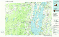
1986 Map of Lake Champlain North
USGS Topo · Published 1986About this map
The northern reaches of Lake Champlain anchor this mid-1980s landscape where the international border meets the eastern edge of the Adirondacks. The map reveals a transition from the agricultural flats near Mooers and Chazy River to the prominent peaks of Lyon Mountain and Dannemora Mountain in the west. This era shows the significant military footprint in the region, centered on Plattsburgh Air Force Base and the Plattsburgh city center, while the Delaware and Hudson RR and Central Vermont RR illustrate the historical transportation corridors that long served this borderland.
Find a feature on this map
310 named features on this map. Tap any name to fly to it.
Don’t see what you’re looking for? This feature index may not catch every label — zoom into the map to look around manually.
Map Details
Editions of this 1986 Lake Champlain North Map
2 editions found
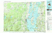
Other maps of this area

1894 · Plattsburg
USGS Topo · 1:62,500

1895 · Mooers
USGS Topo · 1:62,500

1895 · Rouse Point
USGS Topo · 1:62,500

1895 · Willsboro
USGS Topo · 1:62,500

1895 · Ausable
USGS Topo · 1:62,500

1896 · Lake Placid
USGS Topo · 1:62,500

1898 · Lake Placid
USGS Topo · 1:62,500

1899 · Mooers
USGS Topo · 1:62,500

1902 · Saranac
USGS Topo · 1:62,500

1903 · Ausable
USGS Topo · 1:62,500