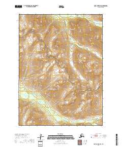
2018 Map of Lake Clark A-3 SE
USGS Topo · Published 2018About this map
Lake Clark National Park and the adjacent Lake Clark National Preserve define this landscape within the Lake and Peninsula Borough. The terrain is characterized by a network of drainage systems, including the Tazimina River, which flows through the southern portion of the quadrangle. Smaller tributaries such as Ospook Cr and Brooks Cr cut through the northern and eastern sections, illustrating the complex hydrography of this wilderness area. The map primarily documents the natural topography and protected boundaries, showing no permanent human settlements or infrastructure. The transition between the Park and Preserve status highlights the varying degrees of conservation management applied to these lands, providing a clear record of federal land designations in the early 21st century.
Find a feature on this map
9 named features on this map. Tap any name to fly to it.
Don’t see what you’re looking for? This feature index may not catch every label — zoom into the map to look around manually.
Map Details
Editions of this 2018 Lake Clark A-3 SE Map
This is the sole edition of this map. No revisions or reprints were ever made.
Other maps of this area

1946 · Lake Clark
USGS Topo · 1:250,000

1951 · Lake Clark
USGS Topo · 1:250,000

1952 · Iliamna
USGS Topo · 1:250,000

1954 · Lake Clark A-3
USGS Topo · 1:63,360

1954 · Iliamna D-3
USGS Topo · 1:63,360

1957 · Iliamna
USGS Topo · 1:250,000

1958 · Iliamna D-2
USGS Topo · 1:63,360
1958 · Lake Clark A-2
USGS Topo · 1:63,360

1958 · Lake Clark
USGS Topo · 1:250,000
2018 · Lake Clark A-3 NE
USGS Topo · 1:25,000