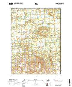
2019 Map of Lake Clark A-6 SW
USGS Topo · Published 2019About this map
Groundhog Mtn dominates the southern portion of this region within the Lake and Peninsula Borough, rising above a landscape defined by braided waterways and extensive wetlands. In the northern reaches, the Chulitna River meanders through a low-lying basin, joined by smaller tributaries like Rock Cr. The topography shifts from these saturated flats to the prominent elevation of the mountain, where Groundhog Cr originates. The absence of roads or established settlements emphasizes the wilderness character of this area, where the primary organizational structures are the legal township boundaries such as t1s r34w and t2s r35w. This document provides a look at the hydrography and elevation before any modern industrial or infrastructure development altered the drainage patterns of the Chulitna basin.
Find a feature on this map
8 named features on this map. Tap any name to fly to it.
Don’t see what you’re looking for? This feature index may not catch every label — zoom into the map to look around manually.
Map Details
Editions of this 2019 Lake Clark A-6 SW Map
This is the sole edition of this map. No revisions or reprints were ever made.
Other maps of this area

1946 · Lake Clark
USGS Topo · 1:250,000

1951 · Lake Clark
USGS Topo · 1:250,000

1952 · Iliamna
USGS Topo · 1:250,000

1954 · Lake Clark A-7
USGS Topo · 1:63,360

1954 · Lake Clark A-6
USGS Topo · 1:63,360

1954 · Iliamna D-7
USGS Topo · 1:63,360
1954 · Iliamna D-6
USGS Topo · 1:63,360

1957 · Iliamna
USGS Topo · 1:250,000

1958 · Lake Clark
USGS Topo · 1:250,000
2019 · Iliamna D-7 NE
USGS Topo · 1:25,000