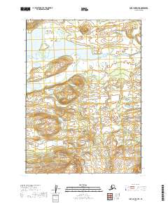
2019 Map of Lake Clark A-7 SE
USGS Topo · Published 2019About this map
Nikabuna Lake and the interconnected Nikabuna Lakes dominate the northern terrain of this quadrangle, forming part of a complex hydrologic system in the Lake Clark region. The Chulitna River winds through the central and eastern portions of the map, serving as a primary drainage for the surrounding lowlands. This survey illustrates the wild, unpopulated character of the Lake and Peninsula Borough as documented in 2019, showing the natural relief and waterway patterns before they reach the larger lake systems to the south. The absence of roads or permanent settlements highlights the isolation of this landscape, where the Public Land Survey System grids t1s r36w and t1s r35w mark the only human-imposed structure on an otherwise undisturbed wilderness.
Find a feature on this map
7 named features on this map. Tap any name to fly to it.
Don’t see what you’re looking for? This feature index may not catch every label — zoom into the map to look around manually.
Map Details
Editions of this 2019 Lake Clark A-7 SE Map
This is the sole edition of this map. No revisions or reprints were ever made.
Other maps of this area

1946 · Lake Clark
USGS Topo · 1:250,000

1951 · Lake Clark
USGS Topo · 1:250,000

1952 · Iliamna
USGS Topo · 1:250,000

1954 · Lake Clark A-7
USGS Topo · 1:63,360

1954 · Lake Clark A-6
USGS Topo · 1:63,360

1954 · Iliamna D-7
USGS Topo · 1:63,360
1954 · Iliamna D-6
USGS Topo · 1:63,360

1957 · Iliamna
USGS Topo · 1:250,000

1958 · Lake Clark
USGS Topo · 1:250,000
2019 · Iliamna D-7 NW
USGS Topo · 1:25,000