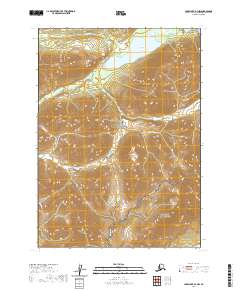
2020 Map of Lake Clark B-3 NW
USGS Topo · Published 2020About this map
Lachbuna Lake sits at the northern edge of this landscape, a prominent water body in a region defined by its complex glacial and riverine geography. The area is divided between the Lake Clark National Park and the Lake Clark National Preserve, protecting a wilderness where the Kijik River and Portage Cr carve through high-elevation terrain. The presence of College Cr in the northwest suggests a network of glacial tributaries feeding into the larger drainage basins. This 2020 survey demonstrates the modern administrative boundaries and preserved land status of the Lake and Peninsula Borough, showing the intersection of park and preserve lands in a territory devoid of permanent roads or settlements.
Find a feature on this map
12 named features on this map. Tap any name to fly to it.
Don’t see what you’re looking for? This feature index may not catch every label — zoom into the map to look around manually.
Map Details
Editions of this 2020 Lake Clark B-3 NW Map
This is the sole edition of this map. No revisions or reprints were ever made.
Other maps of this area

1946 · Lake Clark
USGS Topo · 1:250,000

1951 · Lake Clark
USGS Topo · 1:250,000

1954 · Lake Clark C-3
USGS Topo · 1:63,360

1954 · Lake Clark C-4
USGS Topo · 1:63,360

1954 · Lake Clark B-3
USGS Topo · 1:63,360

1954 · Lake Clark B-4
USGS Topo · 1:63,360

1958 · Lake Clark
USGS Topo · 1:250,000
2018 · Lake Clark B-3 NE
USGS Topo · 1:25,000
2018 · Lake Clark C-4 SE
USGS Topo · 1:25,000
2018 · Lake Clark C-3 SE
USGS Topo · 1:25,000