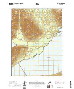
2018 Map of Lake Clark B-4 SE
USGS Topo · Published 2018About this map
Lake Clark dominates the southern reaches of this landscape, its expansive waters meeting the shoreline within the Lake Clark National Park boundary. To the north, the terrain transitions into the Lake Clark National Preserve, where the elevation rises toward the prominent summit of Kijik Mtn. This area is defined by a significant drainage system, with the Kijik River flowing south through the valleys to reach Kijik Lake. The interplay between these water bodies and the sharp relief of the mountains highlights a preserved wilderness within the Lake and Peninsula Borough. The map records the precise coordinates of the Public Land Survey System, including t3n r29w and t2n r28w, providing a detailed look at the geographical division between the national park and preserve lands.
Find a feature on this map
10 named features on this map. Tap any name to fly to it.
Don’t see what you’re looking for? This feature index may not catch every label — zoom into the map to look around manually.
Map Details
Editions of this 2018 Lake Clark B-4 SE Map
This is the sole edition of this map. No revisions or reprints were ever made.
Other maps of this area

1946 · Lake Clark
USGS Topo · 1:250,000

1951 · Lake Clark
USGS Topo · 1:250,000

1954 · Lake Clark A-3
USGS Topo · 1:63,360

1954 · Lake Clark B-3
USGS Topo · 1:63,360

1954 · Lake Clark A-4
USGS Topo · 1:63,360

1954 · Lake Clark B-4
USGS Topo · 1:63,360

1958 · Lake Clark
USGS Topo · 1:250,000
2018 · Lake Clark A-4 NW
USGS Topo · 1:25,000
2018 · Lake Clark B-4 NW
USGS Topo · 1:25,000
2018 · Lake Clark B-4 NE
USGS Topo · 1:25,000