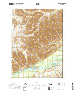
2019 Map of Lake Clark B-8 NW
USGS Topo · Published 2019About this map
The Mulchatna River snakes across the southern reaches of this landscape in the Lake and Peninsula Borough, providing a vital waterway for travel and subsistence in this part of Alaska. Moving north, the terrain rises into upland drainages where Springway Cr flows through the hills. This remote corridor is defined by its lack of established roads and settlements, reflecting a landscape still organized by natural hydrology and the Public Land Survey System. The map documents the vast townships of t4n r38w and t5n r38w, showing the precise coordinate grid used to manage these expansive northern territories where water remains the primary landmark for navigation.
Find a feature on this map
9 named features on this map. Tap any name to fly to it.
Don’t see what you’re looking for? This feature index may not catch every label — zoom into the map to look around manually.
Map Details
Editions of this 2019 Lake Clark B-8 NW Map
This is the sole edition of this map. No revisions or reprints were ever made.
Other maps of this area

1946 · Lake Clark
USGS Topo · 1:250,000

1950 · Taylor Mountains
USGS Topo · 1:250,000

1951 · Lake Clark
USGS Topo · 1:250,000

1951 · Taylor Mountains
USGS Topo · 1:250,000

1954 · Lake Clark C-8
USGS Topo · 1:63,360

1954 · Taylor Mountains
USGS Topo · 1:250,000

1954 · Taylor Mountains C-1
USGS Topo · 1:63,360

1954 · Taylor Mountains B-1
USGS Topo · 1:63,360
1954 · Lake Clark B-8
USGS Topo · 1:63,360

1958 · Lake Clark
USGS Topo · 1:250,000