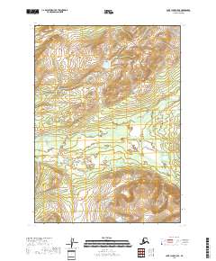
2018 Map of Lake Clark C-5 SE
USGS Topo · Published 2018About this map
The Chilikadrotna River snakes across this sub-arctic terrain in the southern reaches of the Alaska Range, carving through a landscape defined by glacial activity and drainage patterns. This 2018 survey captures the intricate waterway networks of the Little Mulchatna River, documenting a wilderness largely devoid of permanent human infrastructure or named settlements. The map centers on the survey boundaries of t6n r31w, t6n r30w, t5n r31w, and t5n r30w, illustrating how the high-elevation contours descend toward these vital river valleys. Researchers can study the subtle shift in elevation and the braided nature of the glacial streams as they appeared in the early 21st century.
Find a feature on this map
6 named features on this map. Tap any name to fly to it.
Don’t see what you’re looking for? This feature index may not catch every label — zoom into the map to look around manually.
Map Details
Editions of this 2018 Lake Clark C-5 SE Map
This is the sole edition of this map. No revisions or reprints were ever made.
Other maps of this area

1946 · Lake Clark
USGS Topo · 1:250,000

1951 · Lake Clark
USGS Topo · 1:250,000

1954 · Lake Clark C-4
USGS Topo · 1:63,360

1954 · Lake Clark B-5
USGS Topo · 1:63,360

1954 · Lake Clark C-5
USGS Topo · 1:63,360

1954 · Lake Clark B-4
USGS Topo · 1:63,360

1958 · Lake Clark
USGS Topo · 1:250,000
2018 · Lake Clark C-4 NW
USGS Topo · 1:25,000
2018 · Lake Clark C-4 SW
USGS Topo · 1:25,000
2018 · Lake Clark C-5 NW
USGS Topo · 1:25,000