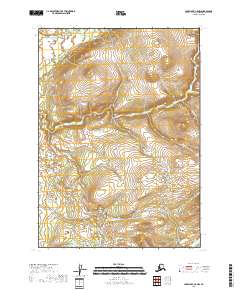
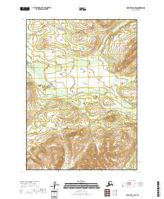
2018 Map of Lake Clark C-5 NW
USGS Topo · Published 2018About this map
Bonanza Cr and its numerous tributaries dominate this drainage-focused survey within the Lake and Peninsula Borough. The landscape is defined by high-elevation watershed divides and the complex network of headwaters including Little Bonanza Cr and Big Bonanza Cr. This area shows a pattern of glacial or fluvial erosion where streams like Caribou Cr and Victoria Cr have carved distinct paths through the high country. The absence of roads or established settlements emphasizes the wilderness character of these townships, which were mapped using data from the National Hydrography Dataset and National Elevation Dataset. Smaller watercourses like Cota Cr, Tom Cr, and Symmetra Cr further illustrate the intricate hydrological system that feeds into the larger regional basins of south-central Alaska.
Find a feature on this map
15 named features on this map. Tap any name to fly to it.
Don’t see what you’re looking for? This feature index may not catch every label — zoom into the map to look around manually.
Map Details
Editions of this 2018 Lake Clark C-5 NW Map
This is the sole edition of this map. No revisions or reprints were ever made.
Other maps of this area

1946 · Lake Clark
USGS Topo · 1:250,000

1951 · Lake Clark
USGS Topo · 1:250,000

1954 · Lake Clark C-6
USGS Topo · 1:63,360

1954 · Lake Clark D-5
USGS Topo · 1:63,360

1954 · Lake Clark C-5
USGS Topo · 1:63,360
1954 · Lake Clark D-6
USGS Topo · 1:63,360

1958 · Lake Clark
USGS Topo · 1:250,000
2018 · Lake Clark D-5 SW
USGS Topo · 1:25,000
2018 · Lake Clark D-5 SE
USGS Topo · 1:25,000
2018 · Lake Clark C-5 SW
USGS Topo · 1:25,000