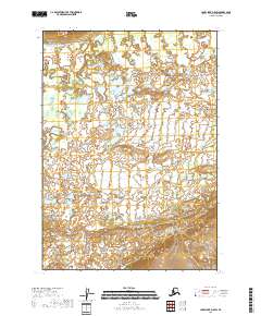
2018 Map of Lake Clark D-5 SW
USGS Topo · Published 2018About this map
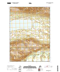
Mulchatna River meanders across the upper reaches of this subarctic landscape, carving a serpentine path through the northern sections of the Lake and Peninsula Borough. The terrain is defined by a dense network of small ponds and wetlands, particularly concentrated near Half Cabin Lake in the western half of the quadrangle. This 2018 survey reveals a largely unpopulated area where the natural drainage patterns of the tundra remain undisturbed. The detailed contour lines in the southern portion of the map indicate significant elevation changes, contrasting with the more level, water-heavy flats to the north, which are typical of the interior Alaskan river valleys.
Find a feature on this map
6 named features on this map. Tap any name to fly to it.
Don’t see what you’re looking for? This feature index may not catch every label — zoom into the map to look around manually.
Map Details
Editions of this 2018 Lake Clark D-5 SW Map
This is the sole edition of this map. No revisions or reprints were ever made.
Other maps of this area

1946 · Lake Clark
USGS Topo · 1:250,000

1951 · Lake Clark
USGS Topo · 1:250,000

1954 · Lake Clark C-6
USGS Topo · 1:63,360

1954 · Lake Clark D-5
USGS Topo · 1:63,360

1954 · Lake Clark C-5
USGS Topo · 1:63,360
1954 · Lake Clark D-6
USGS Topo · 1:63,360

1958 · Lake Clark
USGS Topo · 1:250,000
2018 · Lake Clark C-5 NW
USGS Topo · 1:25,000
2018 · Lake Clark D-5 SE
USGS Topo · 1:25,000
2018 · Lake Clark D-5 NW
USGS Topo · 1:25,000