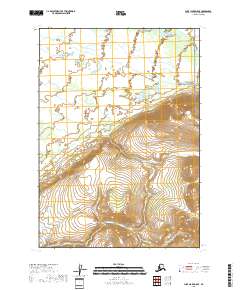
2018 Map of Lake Clark D-5 SE
USGS Topo · Published 2018About this map
Lake Clark National Preserve covers the northeastern portion of this topographic study, where the tundra landscape transitions into the prominent Bonanza Hills. This area of southwestern Alaska is defined by a complex drainage system feeding into the Mulchatna River, which meanders across the northern reaches of the quadrangle. The steep, closely-spaced contours of the hills to the south contrast sharply with the wetland-dense lowlands to the north, illustrating the characteristic transition from upland ridges to river basins. Glacial and snowmelt runoff is traced through several named waterways, including Glacier Cr, Pass Cr, and Bonanza Cr. The lack of road infrastructure or established settlements emphasizes the wilderness character of this region within the Lake and Peninsula Borough, where surveying was conducted using SPOT imagery and National Hydrography Dataset records to map the remote hydrology.
Find a feature on this map
10 named features on this map. Tap any name to fly to it.
Don’t see what you’re looking for? This feature index may not catch every label — zoom into the map to look around manually.
Map Details
Editions of this 2018 Lake Clark D-5 SE Map
This is the sole edition of this map. No revisions or reprints were ever made.
Other maps of this area

1946 · Lake Clark
USGS Topo · 1:250,000

1951 · Lake Clark
USGS Topo · 1:250,000

1954 · Lake Clark C-4
USGS Topo · 1:63,360

1954 · Lake Clark D-5
USGS Topo · 1:63,360

1954 · Lake Clark C-5
USGS Topo · 1:63,360

1954 · Lake Clark D-4
USGS Topo · 1:63,360

1958 · Lake Clark
USGS Topo · 1:250,000
2018 · Lake Clark D-4 NW
USGS Topo · 1:25,000
2018 · Lake Clark C-4 NW
USGS Topo · 1:25,000
2018 · Lake Clark C-5 NW
USGS Topo · 1:25,000