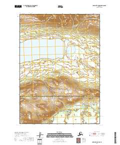
2018 Map of Lake Clark D-5 NW
USGS Topo · Published 2018About this map
Whitefish Lake sits at the center of this remote Alaskan terrain, where the northern watershed is defined by the Hoholitna River and the southern drainage flows into the Mulchatna River. The 2018 survey documents a landscape largely shaped by these major water systems, spanning the administrative boundary between the Bethel Census Area and the Lake and Peninsula Borough. The absence of roads or permanent settlements highlights the wilderness character of the region, emphasizing the importance of these navigable rivers for seasonal transit and traditional land use within the interior. This topographic study provides a baseline for tracking hydrological shifts and land boundaries in an area defined by its significant glacial and fluvial features.
Find a feature on this map
4 named features on this map. Tap any name to fly to it.
Don’t see what you’re looking for? This feature index may not catch every label — zoom into the map to look around manually.
Map Details
Editions of this 2018 Lake Clark D-5 NW Map
This is the sole edition of this map. No revisions or reprints were ever made.
Other maps of this area

1946 · Lake Clark
USGS Topo · 1:250,000

1951 · Lake Clark
USGS Topo · 1:250,000

1951 · Lime Hills
USGS Topo · 1:250,000

1954 · Lime Hills A-5
USGS Topo · 1:63,360

1954 · Lake Clark D-5
USGS Topo · 1:63,360

1954 · Lime Hills A-6
USGS Topo · 1:63,360
1954 · Lake Clark D-6
USGS Topo · 1:63,360

1958 · Lake Clark
USGS Topo · 1:250,000

1958 · Lime Hills
USGS Topo · 1:250,000
2018 · Lake Clark D-5 SW
USGS Topo · 1:25,000