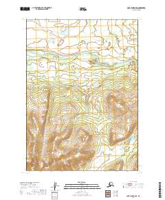
2019 Map of Lake Clark C-6 SE
USGS Topo · Published 2019About this map
Chilikadrotna River flows westward through the northern reaches of this landscape, carving a prominent valley through the public land survey townships of t6n r33w and t6n r32w. The terrain is defined by dramatic elevation changes, with steep slopes and ridge lines rising toward the south. In the southeastern corner, the Chilchitna River cuts across the corner of t5n r32w, suggesting a complex drainage pattern in this unsettled Alaskan wilderness. Without roads or permanent settlements recorded, the map highlights a primitive landscape where watercourses serve as the primary geographical markers for navigation and land division within the Lake and Peninsula Borough.
Find a feature on this map
6 named features on this map. Tap any name to fly to it.
Don’t see what you’re looking for? This feature index may not catch every label — zoom into the map to look around manually.
Map Details
Editions of this 2019 Lake Clark C-6 SE Map
This is the sole edition of this map. No revisions or reprints were ever made.
Other maps of this area

1946 · Lake Clark
USGS Topo · 1:250,000

1951 · Lake Clark
USGS Topo · 1:250,000

1954 · Lake Clark C-6
USGS Topo · 1:63,360

1954 · Lake Clark B-5
USGS Topo · 1:63,360

1954 · Lake Clark C-5
USGS Topo · 1:63,360

1954 · Lake Clark B-6
USGS Topo · 1:63,360

1958 · Lake Clark
USGS Topo · 1:250,000
2018 · Lake Clark C-5 NW
USGS Topo · 1:25,000
2018 · Lake Clark B-5 NW
USGS Topo · 1:25,000
2018 · Lake Clark C-5 SW
USGS Topo · 1:25,000