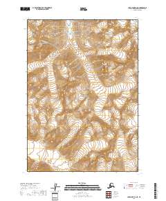
2018 Map of Lake Clark D-1 NE
USGS Topo · Published 2018About this map
Lake Clark National Park encompasses the entirety of this interior Alaskan landscape, which is defined by high-elevation glacial terrain and steep vertical relief. The map illustrates a complex network of ridgelines and summits, with some peaks exceeding 6,000 feet in height. These alpine environments are characterized by extensive permanent snowfields and ice, separated by deeply carved drainage basins. This 2018 survey provides a clear view of the wilderness before the impact of modern infrastructure, showing an area devoid of roads or permanent settlements. The topographic data, sourced from the National Elevation Dataset between 2001 and 2018, reveals the intricate landforms that define the Kenai Peninsula Borough's rugged interior. The map focuses on the legal divisions of the Public Land Survey System, specifically detailing townships such as t10n r22w and t11n r21w.
Find a feature on this map
7 named features on this map. Tap any name to fly to it.
Don’t see what you’re looking for? This feature index may not catch every label — zoom into the map to look around manually.
Map Details
Editions of this 2018 Lake Clark D-1 NE Map
This is the sole edition of this map. No revisions or reprints were ever made.
Other maps of this area

1944 · Kenai
USGS Topo · 1:250,000

1946 · Lake Clark
USGS Topo · 1:250,000

1949 · Tyonek
USGS Topo · 1:250,000

1950 · Kenai
USGS Topo · 1:250,000

1951 · Lake Clark
USGS Topo · 1:250,000

1951 · Tyonek
USGS Topo · 1:250,000

1951 · Lime Hills
USGS Topo · 1:250,000

1958 · Kenai D-8
USGS Topo · 1:63,360

1958 · Tyonek
USGS Topo · 1:250,000

1958 · Tyonek A-8
USGS Topo · 1:63,360