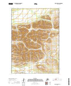
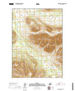
2019 Map of Lake Clark D-7 SE
USGS Topo · Published 2019About this map
Halfway Mtn rises as a prominent landmark in this interior Alaskan landscape, which is defined by the headwaters of the South Holitna River. The drainage pattern suggests a complex network of high-elevation streams, including Gnat Cr to the north and the westward-flowing Summit Cr. In the southern portion of the quadrangle, McKinley Cr winds through the base of the mountains, illustrating the typical hydrography of the Lake and Peninsula Borough before these waters reach more established river valleys. This USGS survey documents the topographic layout of the region, focusing on the natural contours and named water bodies that serve as the primary identifiers in an area largely devoid of man-made structures or road networks.
Find a feature on this map
9 named features on this map. Tap any name to fly to it.
Don’t see what you’re looking for? This feature index may not catch every label — zoom into the map to look around manually.
Map Details
Editions of this 2019 Lake Clark D-7 SE Map
This is the sole edition of this map. No revisions or reprints were ever made.
Other maps of this area

1946 · Lake Clark
USGS Topo · 1:250,000

1951 · Lake Clark
USGS Topo · 1:250,000

1954 · Lake Clark C-7
USGS Topo · 1:63,360

1954 · Lake Clark C-6
USGS Topo · 1:63,360

1954 · Lake Clark D-7
USGS Topo · 1:63,360
1954 · Lake Clark D-6
USGS Topo · 1:63,360

1958 · Lake Clark
USGS Topo · 1:250,000
2019 · Lake Clark D-6 NW
USGS Topo · 1:25,000
2019 · Lake Clark D-7 NE
USGS Topo · 1:25,000
2019 · Lake Clark D-7 SW
USGS Topo · 1:25,000