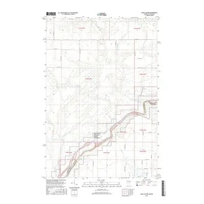
2016 Map of Lake Clayton
USGS Topo · Published 2016About this map
The Saint Croix National Scenic Riverway dominates the southern landscape of this border region, where the Saint Croix River forms the natural boundary between Minnesota and Wisconsin. The area is defined by its intricate wetlands and water systems, including the Kettle River and the braided Kettle River Slough. Settlement patterns are traced by a grid of rural routes such as Old Town Hall Rd and Fire Tower Rd, reflecting the timber and agricultural history of Pine and Burnett counties. Local family and place names are preserved in landmarks like Lake Clayton, Fuhrman Lake, and Bear Creek. The concentration of landing sites like Foxes Landing Rd and Nelsons Landing Rd highlights the river's historic role as a primary artery for transportation and recreation in these north woods.
Find a feature on this map
50 named features on this map. Tap any name to fly to it.
Don’t see what you’re looking for? This feature index may not catch every label — zoom into the map to look around manually.
Map Details
Editions of this 2016 Lake Clayton Map
This is the sole edition of this map. No revisions or reprints were ever made.
Other maps of this area

1950 · Grantsburg
USGS Topo · 1:48,000

1953 · Duluth
USGS Topo · 1:250,000

1953 · Stillwater
USGS Topo · 1:250,000

1955 · Stillwater
USGS Topo · 1:250,000

1958 · Stillwater
USGS Topo · 1:250,000

1958 · Duluth
USGS Topo · 1:250,000

1961 · Sandstone
USGS Topo · 1:62,500

1961 · Pine City
USGS Topo · 1:62,500

1962 · Cloverdale
USGS Topo · 1:62,500

1962 · Grantsburg
USGS Topo · 1:62,500