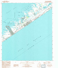
1994 Map of Lake Como
USGS Topo · Published 1994About this map
Galveston Island's coastal morphology is captured here during the mid-1990s, revealing a landscape defined by the transition from the Gulf of Mexico to the intricate network of inlets on West Bay. The area shows a distinct contrast between the developed corridors of Jamaica Beach and Nottingham and the preserved marshlands of Galveston Island State Park. The shoreline is heavily indented by features such as Dalehite Cove, Starvation Cove, and Dana Cove, reflecting the complex hydrology of the barrier island.
Find a feature on this map
42 named features on this map. Tap any name to fly to it.
Don’t see what you’re looking for? This feature index may not catch every label — zoom into the map to look around manually.
Map Details
Editions of this 1994 Lake Como Map
This is the sole edition of this map. No revisions or reprints were ever made.
Other maps of this area

1929 · Karankawa Lake
USGS Topo · 1:24,000

1929 · Hitchcock
USGS Topo · 1:24,000

1929 · Virginia Point
USGS Topo · 1:24,000

1930 · Galveston
USGS Topo · 1:24,000

1931 · Lake Como
USGS Topo · 1:24,000

1932 · Hitchcock
USGS Topo · 1:31,680

1932 · Virginia Point
USGS Topo · 1:31,680

1933 · Karankawa Lake
USGS Topo · 1:31,680

1933 · San Luis Pass
USGS Topo · 1:31,680
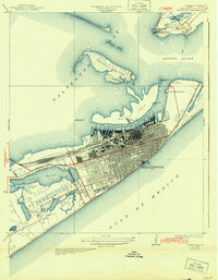
1933 · Galveston
USGS Topo · 1:31,680