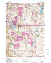
1967 Map of Lake Elmo
USGS Topo · Published 1993About this map
Lake Elmo and the surrounding lake country of Washington County are shown here during a period of significant suburban expansion east of St. Paul. The map captures the rapid development of Oakdale and Woodbury, where new residential grids begin to replace agricultural land. This transition is marked by the presence of several educational institutions, such as Archbishop Murray Sch and Transfiguration Sch, alongside more established landmarks like the Correctional Institution.
Find a feature on this map
43 named features on this map. Tap any name to fly to it.
Don’t see what you’re looking for? This feature index may not catch every label — zoom into the map to look around manually.
Map Details
Editions of this 1967 Lake Elmo Map
4 editions found
Other maps of this area

1896 · St. Paul
USGS Topo · 1:62,500

1902 · White Bear
USGS Topo · 1:62,500

1946 · Hudson
USGS Topo · 1:62,500

1948 · Stillwater
USGS Topo · 1:62,500

1949 · Hudson
USGS Topo · 1:62,500

1949 · Stillwater
USGS Topo · 1:62,500

1949 · Lake Elmo
USGS Topo · 1:24,000

1949 · Hudson
USGS Topo · 1:24,000

1950 · Lake Elmo
USGS Topo · 1:24,000

1950 · Hudson
USGS Topo · 1:24,000