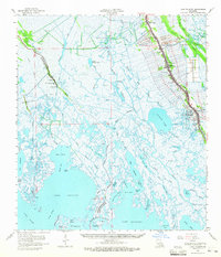
1964 Map of Lake Felicity
USGS Topo · Published 1965About this map
Bayou Lafourche serves as the primary artery for settlement and commerce on this mid-1960s coastal survey, with La 1 and La 308 flanking its banks. The map reveals a dense ribbon of habitation through Galliano and Golden Meadow, where numerous family cemeteries like Cheramie Cem and Guidry Cem neighbor landmarks such as St Joseph Ch and the Radio Tower (KLEB). This concentrated development along the levees contrasts sharply with the vast wetlands to the west and south.
Find a feature on this map
85 named features on this map. Tap any name to fly to it.
Don’t see what you’re looking for? This feature index may not catch every label — zoom into the map to look around manually.
Map Details
Editions of this 1964 Lake Felicity Map
3 editions found
Other maps of this area

1892 · Barataria
USGS Topo · 1:62,500

1892 · Cheniere Caminada
USGS Topo · 1:62,500

1892 · Cut-Off
USGS Topo · 1:62,500

1892 · Houma
USGS Topo · 1:62,500

1892 · Creole
USGS Topo · 1:62,500

1894 · Timbalier
USGS Topo · 1:62,500

1894 · Lake Felicity
USGS Topo · 1:62,500

1894 · Dulac
USGS Topo · 1:62,500

1932 · Houma SE
USGS Topo · 1:31,680

1935 · Bourbeux
USGS Topo · 1:31,680