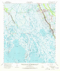
1964 Map of Lake Felicity
USGS Topo · Published 1972About this map
Bayou Lafourche serves as the central artery for human activity on this mid-1960s survey of the Louisiana wetlands. Narrow, linear land tracts extend from the bayou's banks, supporting the densely settled communities of Galliano and Golden Meadow. This ribbon-like development pattern reflects the historic long-lot surveying system common to the region's French heritage, where access to the water was essential for transport and drainage. Beyond the primary channel, the landscape dissolves into a complex network of marshes, canals, and bays.
Find a feature on this map
65 named features on this map. Tap any name to fly to it.
Don’t see what you’re looking for? This feature index may not catch every label — zoom into the map to look around manually.
Map Details
Editions of this 1964 Lake Felicity Map
3 editions found
Other maps of this area

1892 · Barataria
USGS Topo · 1:62,500

1892 · Cheniere Caminada
USGS Topo · 1:62,500

1892 · Cut-Off
USGS Topo · 1:62,500

1892 · Houma
USGS Topo · 1:62,500

1892 · Creole
USGS Topo · 1:62,500

1894 · Timbalier
USGS Topo · 1:62,500

1894 · Lake Felicity
USGS Topo · 1:62,500

1894 · Dulac
USGS Topo · 1:62,500

1932 · Houma SE
USGS Topo · 1:31,680

1935 · Bourbeux
USGS Topo · 1:31,680