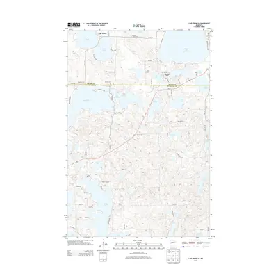
2013 Map of Lake Franklin
USGS Topo · Published 2013About this map
Lake Eunice and its surrounding glacial terrain define this portion of the Minnesota lake country, straddling the border of Becker Co and Otter Tail Co. The map reveals a dense network of water bodies and recreational infrastructure, where the Pelican River connects Little Pelican Lake and Holbrook Lake. At the settlement of Bucks Mill, the convergence of Mill Lake, Buck Lake, and Mill Pond indicates a landscape historically shaped by water power and management, now characterized by residential enclaves and summer homes along shores like Newport Beach Rd.
Find a feature on this map
75 named features on this map. Tap any name to fly to it.
Don’t see what you’re looking for? This feature index may not catch every label — zoom into the map to look around manually.
Map Details
Editions of this 2013 Lake Franklin Map
This is the sole edition of this map. No revisions or reprints were ever made.
Other maps of this area

1912 · Vergas
USGS Topo · 1:62,500

1914 · Pelican Rapids
USGS Topo · 1:62,500

1915 · Vergas
USGS Topo · 1:62,500

1917 · Pelican Rapids
USGS Topo · 1:62,500

1953 · Fargo
USGS Topo · 1:250,000

1953 · Brainerd
USGS Topo · 1:250,000

1956 · Fargo
USGS Topo · 1:250,000

1957 · Brainerd
USGS Topo · 1:250,000

1958 · Brainerd
USGS Topo · 1:250,000
1959 · Audubon
USGS Topo · 1:24,000