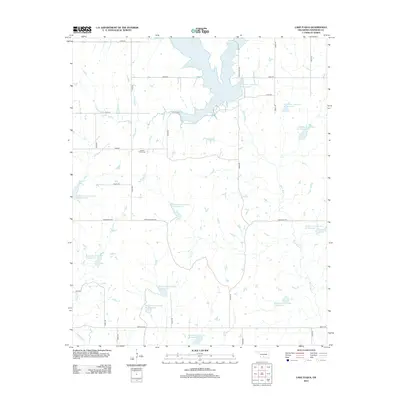
2012 Map of Lake Fuqua
USGS Topo · Published 2012About this map
Lake Fuqua dominates the northern reaches of this Stephens County landscape, serving as the primary anchor for a complex network of water management features. The surrounding terrain is defined by an extensive series of flood control structures, including Wildhorse Creek Site 39 Reservoir and Wildhorse Creek Site 40 Reservoir, which regulate the drainage of Wildhorse Creek and its tributaries. This concentration of reservoirs suggests a heavily engineered rural landscape designed to manage the watershed south of the city of Duncan.
Find a feature on this map
40 named features on this map. Tap any name to fly to it.
Don’t see what you’re looking for? This feature index may not catch every label — zoom into the map to look around manually.
Map Details
Editions of this 2012 Lake Fuqua Map
This is the sole edition of this map. No revisions or reprints were ever made.
Other maps of this area

1901 · Addington
USGS Topo · 1:125,000

1902 · Rush Springs
USGS Topo · 1:125,000

1950 · Marlow
USGS Topo · 1:62,500

1951 · Marlow
USGS Topo · 1:62,500

1957 · Ardmore
USGS Topo · 1:250,000

1963 · Ardmore
USGS Topo · 1:250,000

1963 · Harrisburg
USGS Topo · 1:24,000
1974 · Pernell
USGS Topo · 1:24,000
1974 · Ratliff City
USGS Topo · 1:24,000
1974 · Purdy
USGS Topo · 1:24,000