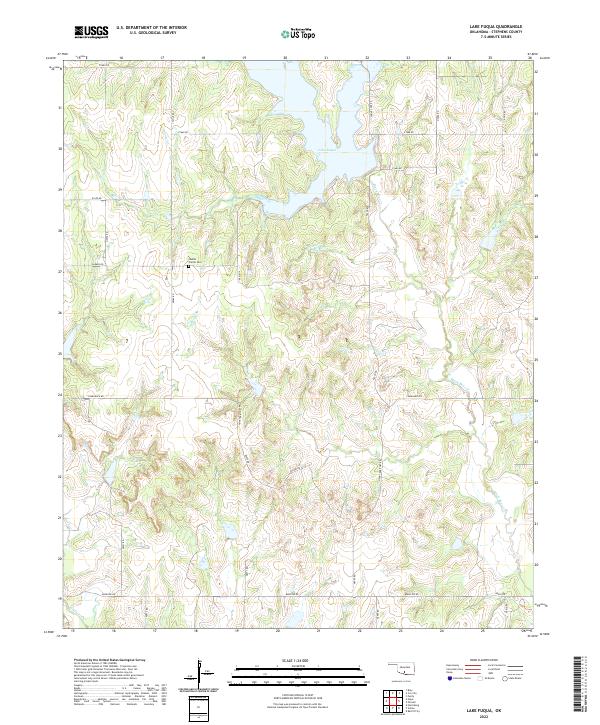
2022 Map of Lake Fuqua
USGS Topo · Published 2022About this map
Lake Fuqua and its surrounding watershed dominate this portion of Stephens County, Oklahoma, where the landscape is defined by the dendritic drainage patterns of Black Bear Cr and Wildhorse Cr. The area maintains a predominantly rural character, organized by the section lines of the Public Land Survey System that govern the modern road network. This pattern of land use is punctuated by specific sites of local historical significance, such as Owens Prairie Cem, which serves as a vital anchor for genealogical research in the region. The presence of routes like Hope Territory Rd and Camelback Rd among the survey-grid roads reflects the localized naming conventions of the modern era, while the expansive hydrography of Queens Cr and other tributaries illustrates the natural geography that once dictated early settlement locations and land claims in the southern Oklahoma territory.
Find a feature on this map
34 named features on this map. Tap any name to fly to it.
Don’t see what you’re looking for? This feature index may not catch every label — zoom into the map to look around manually.
Map Details
Editions of this 2022 Lake Fuqua Map
This is the sole edition of this map. No revisions or reprints were ever made.
Other maps of this area

1901 · Addington
USGS Topo · 1:125,000

1902 · Rush Springs
USGS Topo · 1:125,000

1950 · Marlow
USGS Topo · 1:62,500

1951 · Marlow
USGS Topo · 1:62,500

1957 · Ardmore
USGS Topo · 1:250,000

1963 · Ardmore
USGS Topo · 1:250,000

1963 · Harrisburg
USGS Topo · 1:24,000
1974 · Pernell
USGS Topo · 1:24,000
1974 · Ratliff City
USGS Topo · 1:24,000
1974 · Purdy
USGS Topo · 1:24,000