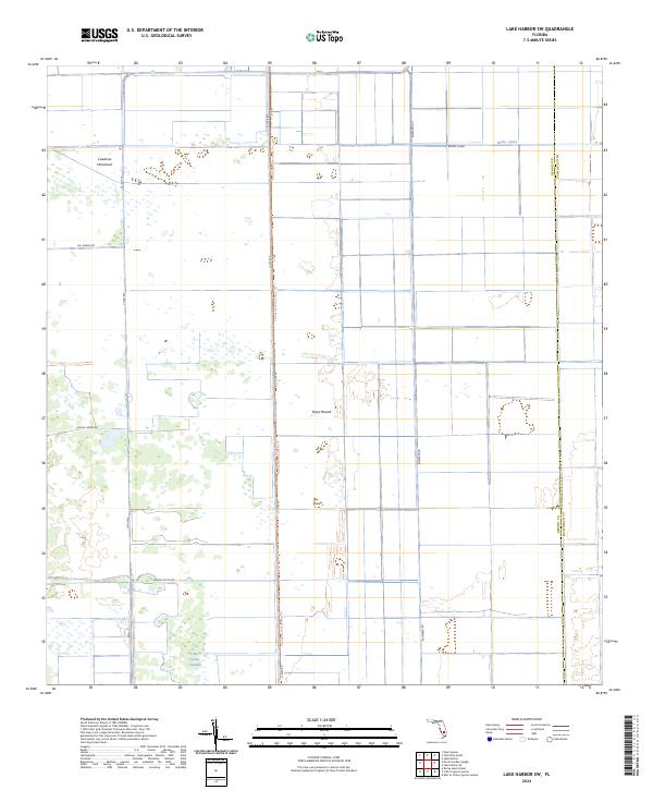
2024 Map of Lake Harbor SW
USGS Topo · Published 2024About this map
Tonys Mound and Cowbone Hammock rise as distinct natural landmarks within this managed landscape on the border of Hendry and Palm Beach counties. The area is defined by a rigorous grid of agricultural and access roads, including Hill Grade Rd and Dooley Grade Rd, which overlay a territory historically dominated by the Little Cypress Swamp. The Florida National Scenic Trl provides a continuous north-south corridor for travelers, following the alignment of L1 Dike Rd and L1 Rd. Water management infrastructure is prominent throughout the quadrangle, anchored by the east-west flow of the Bolles Canal in the northern reaches. This 2024 survey documents the modern intersection of recreational trails, commercial agriculture, and the persistence of native hammocks and wetlands in the Florida interior.
Find a feature on this map
23 named features on this map. Tap any name to fly to it.
Don’t see what you’re looking for? This feature index may not catch every label — zoom into the map to look around manually.
Map Details
Editions of this 2024 Lake Harbor SW Map
This is the sole edition of this map. No revisions or reprints were ever made.
Other maps of this area

1956 · West Palm Beach
USGS Topo · 1:250,000

1957 · West Palm Beach
USGS Topo · 1:250,000

1958 · West Palm Beach
USGS Topo · 1:250,000

1970 · Lake Harbor
USGS Topo · 1:24,000

1970 · Lake Harbor SE
USGS Topo · 1:24,000

1970 · Lake Harbor SW
USGS Topo · 1:24,000

1970 · Clewiston South
USGS Topo · 1:24,000

1970 · La Belle 4 SE
USGS Topo · 1:24,000

1970 · La Belle 4 NE
USGS Topo · 1:24,000

1974 · Immokalee 1 NE
USGS Topo · 1:24,000