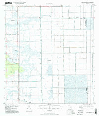
1994 Map of Lake Harbor SW
USGS Topo · Published 1998About this map
Tonys Mound rises as a distinct landmark within the interior wetlands of South Florida, sitting near the boundary where Hendry Co meets Palm Beach Co. This 1994 photo-inspection reveals a landscape defined by water management and localized terrain features, where the straight lines of the L-2 Canal and Bolles Canal intersect the natural patterns of the Little Cypress Swamp. The map documents a period when the area was primarily utilized for drainage and small-scale resource extraction, as evidenced by several Gravel Pits located along Dooley Road. Local landmarks like Cowbone Hammock and a designated Picnic Area suggest pockets of recreation and higher ground amidst the glades, while the grid of Pumps highlights the intensive engineering required to maintain the region's hydrological balance during the late twentieth century.
Find a feature on this map
11 named features on this map. Tap any name to fly to it.
Don’t see what you’re looking for? This feature index may not catch every label — zoom into the map to look around manually.
Map Details
Editions of this 1994 Lake Harbor SW Map
This is the sole edition of this map. No revisions or reprints were ever made.
Other maps of this area

1956 · West Palm Beach
USGS Topo · 1:250,000

1957 · West Palm Beach
USGS Topo · 1:250,000

1958 · West Palm Beach
USGS Topo · 1:250,000

1970 · Lake Harbor
USGS Topo · 1:24,000

1970 · Lake Harbor SE
USGS Topo · 1:24,000

1970 · Lake Harbor SW
USGS Topo · 1:24,000

1970 · Clewiston South
USGS Topo · 1:24,000

1970 · La Belle 4 SE
USGS Topo · 1:24,000

1970 · La Belle 4 NE
USGS Topo · 1:24,000

1974 · Immokalee 1 NE
USGS Topo · 1:24,000