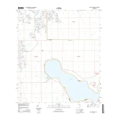
2015 Map of Lake Hatchineha
USGS Topo · Published 2015About this map
Lake Hatchineha dominates this central Florida landscape, situated on the border of Polk and Osceola Counties. The map reveals a transition between the suburban expansion in the northwest and the wetland ecosystems of the London Island and Johnson Island areas. Residential development is clustered along streets like Villa Park Rd and Glendora Rd, while the hydrology of the region is defined by the convergence of London Creek, Lake Marion Cr, and Reedy Cr. This 2015 survey illustrates how modern infrastructure interacts with the natural drainage basins, showing the intricate network of canals and creeks that feed into the lake. The placement of Lake Russell and Deer Lake further emphasizes the low-lying, water-dependent geography characteristic of the Kissimmee River basin before it flows southward.
Find a feature on this map
114 named features on this map. Tap any name to fly to it.
Don’t see what you’re looking for? This feature index may not catch every label — zoom into the map to look around manually.
Map Details
Editions of this 2015 Lake Hatchineha Map
This is the sole edition of this map. No revisions or reprints were ever made.
Other maps of this area

1952 · Lake Wales
USGS Topo · 1:24,000

1952 · Lake Weohyakapka NE
USGS Topo · 1:24,000

1952 · Hesperides
USGS Topo · 1:24,000

1953 · Cypress Lake
USGS Topo · 1:24,000

1953 · Dundee
USGS Topo · 1:24,000

1953 · Lake Hatchineha
USGS Topo · 1:24,000

1953 · St Cloud South
USGS Topo · 1:24,000

1953 · Lake Tohopekaliga
USGS Topo · 1:24,000

1953 · Davenport
USGS Topo · 1:24,000

1955 · Orlando
USGS Topo · 1:250,000