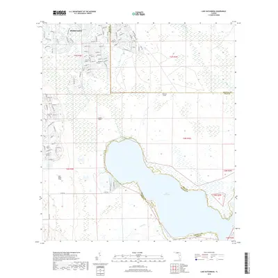
2018 Map of Lake Hatchineha
USGS Topo · Published 2018About this map
Lake Hatchineha dominates this central Florida landscape, situated along the county line where the waters of London Cr and Reedy Cr converge. The terrain is defined by low-lying wetlands and subtle elevations like London Island and Johnson Island, while the western edge of the quadrangle rises toward the Lake Wales Ridge. This area shows a distinct contrast between the intricate residential street networks of Poinciana in the northwest and the expansive, undeveloped marshlands to the south and east. Numerous residential roads such as Bell Tower Xing and Coronado Dr reflect modern suburban expansion into a region historically characterized by lakes like Lake Russell and Lake Marion. The presence of Catfish Cr and Cobb Marsh underscores the hydrological connectivity of the Kissimmee River system prior to further drainage or development.
Find a feature on this map
107 named features on this map. Tap any name to fly to it.
Don’t see what you’re looking for? This feature index may not catch every label — zoom into the map to look around manually.
Map Details
Editions of this 2018 Lake Hatchineha Map
This is the sole edition of this map. No revisions or reprints were ever made.
Other maps of this area

1952 · Lake Wales
USGS Topo · 1:24,000

1952 · Lake Weohyakapka NE
USGS Topo · 1:24,000

1952 · Hesperides
USGS Topo · 1:24,000

1953 · Cypress Lake
USGS Topo · 1:24,000

1953 · Dundee
USGS Topo · 1:24,000

1953 · Lake Hatchineha
USGS Topo · 1:24,000

1953 · St Cloud South
USGS Topo · 1:24,000

1953 · Lake Tohopekaliga
USGS Topo · 1:24,000

1953 · Davenport
USGS Topo · 1:24,000

1955 · Orlando
USGS Topo · 1:250,000