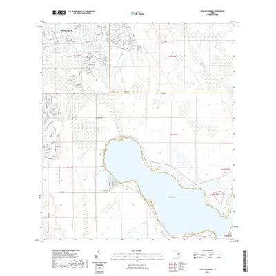
2021 Map of Lake Hatchineha
USGS Topo · Published 2021About this map
The master-planned community of Poinciana occupies the northern section of this landscape, where a dense grid of residential streets like Acadia Dr and Barcelona Dr meets the undeveloped wetlands of the Kissimmee River basin. This modern development contrasts sharply with the expansive natural areas to the south and east, including the Disney Wilderness Preserve Trl. The map centers on the northern reaches of Lake Hatchineha, a significant water body bordered by the low-lying terrain of London Island and Johnson Island.
Find a feature on this map
29 named features on this map. Tap any name to fly to it.
Don’t see what you’re looking for? This feature index may not catch every label — zoom into the map to look around manually.
Map Details
Editions of this 2021 Lake Hatchineha Map
This is the sole edition of this map. No revisions or reprints were ever made.
Other maps of this area

1952 · Lake Wales
USGS Topo · 1:24,000

1952 · Lake Weohyakapka NE
USGS Topo · 1:24,000

1952 · Hesperides
USGS Topo · 1:24,000

1953 · Cypress Lake
USGS Topo · 1:24,000

1953 · Dundee
USGS Topo · 1:24,000

1953 · Lake Hatchineha
USGS Topo · 1:24,000

1953 · St Cloud South
USGS Topo · 1:24,000

1953 · Lake Tohopekaliga
USGS Topo · 1:24,000

1953 · Davenport
USGS Topo · 1:24,000

1955 · Orlando
USGS Topo · 1:250,000